Diane and I went to Alpine, Wyoming to stay at the Rockin'M and fish on the Salt and Snake Rivers. It was a little cool but the fall colors were bursting and we caught fish. A great few days.
Wednesday, October 13, 2010
The Salt and Snake Rivers
Diane and I went to Alpine, Wyoming to stay at the Rockin'M and fish on the Salt and Snake Rivers. It was a little cool but the fall colors were bursting and we caught fish. A great few days.
Monday, August 9, 2010
Father and Daughter in the Subway
Subway, Again. This time with Jamie. She has never hiked it so I snagged a
permit and we drove in Friday night with the intention of getting an early start.That did not happen as the alarm was set for 6pm instead of 6am. That was OK because I was wide awake at 6:32. Jamie said I "flew" out of bed. We prepared our gear the night before so we were on the road in no time. It was about a 35 minute drive to the trailhead. My goal for this hike is always to be hiking by 8am. It is a one way hike and there is a problem of retrieving the car if we leave it at the upper trailhead.
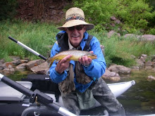
Jamie asked how we were going to get the car shuttled since it was a one way hike,
I answered, "It will be provided!". And it was. A couple of fisherman gave us a
lift... from the lower trailhead to the upper trailhead. After they dropped us
off we noticed the black clouds all around. In fact, one group of guys bailed on
the hike as they were worried about the weather, particularly, flash flooding.
We hit the trail hoping for the best. I could not belive how cool the temperature
was. August in Zion, it was supposed to be 100 degrees. We overcame a group of 3 hikers who had never done the hike before, but they had they weather forecast. More rain, they said. Jamie and I picked up the pace and they sort of shadowed us. They let us do the route finding for them.
We made it down Russell Gulch and up past the sandstone "boob" before it started raining. We hustled toward the cleft chute where I knew we could find shelter but it started pouring before that and out came the raingear. We went down the chute and into the canyon of the Left Fork. We cleared the first obstacle in the usual fashion,
"that sure could have gone better". We no longer worried about the rain for we
would be swimming soon. At the first water obstacle we changed socks to neoprene
booties. Our dry bag kept our water out of food and dry clothes--pretty well. It
was actually a little chilly so we kept moving, rock hopping, wading, and
swimming. At Keyhole Falls, I went first and then Jamie I saw something shiny on
the bottom as we were standing in waist deep water. My camera. Jamie dove down
and retrieved it. It is waterproof, thank goodness. After our last rope descent
I put the rope away(laden with water by now) and we did the hike out staying
mostly in the watercourse. We saw beautiful cascading waterfalls and ever walked through them. The exit was pretty well marked and we began a long
climb up out of the canyon. Thank goodness for the cool weather and no flash
floods.
Sunday, July 18, 2010
Hike of the Week: My Sisters Hike
Life if full of coincidences. Today Diane and I decided to take our "hike of the week" to the Brighton Lakes. The names of the lakes just happen to coincide with(almost) the names of my sisters. We visited Lake Mary, Lake Martha, and Lake Katherine. Well, the last one is pretty close since my sister's name is Kathleen. Anyway, I am calling the hike, My Three Sisters Hike. Since it has been getting hot here lately, we left early and started up the trail by 7:30. It was actually cold when we started out but we knew it would warm up quickly as the sun was starting to peak over the ridges. The wildflowers were just starting to show themselves. I would say that in a week or so they will be in full bloom. We encountered mosquitoes and quickly donned the DEET to keep them off of us. The trail starts out paralleling a ski lift and then enters the woods and was pretty steep. The benefit of our early start was the lack of people. This is a pretty popular hike, especially to the first lake. I remember taking my brother, Mike on this hike years ago. We tried our luck fishing at Lake Mary but had no luck. Lake Mary was the first lake we came to. It had flat, glistening water. We climbed along side it and then on to the next lake, Lake Martha. That is when it hit me, The Three Sisters Hike. From Lake Mary to Lake Katherine was another mile. We passed it by and head steeply up to the Katherine Pass where we could look over into the next canyon, Little Cottonwood Canyon where Snowbird and Alta Ski Resorts reside. It was a steep hike up to the pass but it was a nice place to take in the views. I decided to leave my backpack with Diane and I took off up the ridge line to get an even better view. It was worth the climb. I got even better views of Little Cottonwood Canyon and could see Mount Timpanogas in the distance. I encountered a marmot sunning himself on a rock. It was then back down to where Diane was waiting for me and we headed down the trail, this time taking a route that took us right next to Lake Katherine. We saw some white columbines on the way down. As we got further down the trail we started to come upon the throngs of people coming up and it make us glad we got an early start. It was about two and a half miles to the pass so we put down a good 5 miles. We rewarded ourselves by stopping at the Silver Fork Lodge to have breakfast. After a hearty breakfast of buckwheat pancakes(me) and oatmeal(Diane) we drove back down the canyon. We were home before noon. It was a magnificent way to spend a Sunday morning.
Saturday, July 17, 2010
Thursday, July 15, 2010
Monday, July 12, 2010
Lake Blanche
"Just how early do you want to leave", Diane asked. I said,"Lets sleep in and leave the house at 7:30". Thus started our day on Sunday. We left on time and stopped by Einstein's for bagels and coffee. We headed up Big Cottonwood Canyon. From the time we left our home and traveled to the trailhead, we had covered about 13 miles. What a difference 13 miles can make. The canyon is beautiful from mile one. The stream is still in runoff, but starting to settle down a little bit. I hope to be fishing it soon. As we continued our drive up the canyon, it is difficult to keep your eyes on the road. We arrived at the trailhead with gathering, dark clouds. No worry, we had rain gear. The trail begins gently, enticing us upward. We walked along the stream for a half a mile until we came to a bridge that crossed the stream. From here, the trail climbs, and climbs, and climbs. It has been a few years since we have taken this hike before but we both remembered it being long. We settled in for a slow and steady trek. "Are those raindrops?" asked Diane. Yeah, but not heavy enough to pull out the rain gear. At one point I looked up and saw a friend of mine coming down. Serena(her name fits) is a nurse I know. In fact, I worked with her all last week at a surgical center where I fill in sometimes. It was about 8:30 and I was curious as to what time she had started her hike. Six thirty! She, Diane and I talked for awhile. Serena is going to Rocky Mountain NP at the end of the month and I had just given her all my trip reports from the time I lived in Fort Collins. Earlier, she had to huddle under a tree waiting for some heavy rain to pass. "Where is your rain jacket", I asked. Sheepishly, she said she had forgotten it. Her hike was almost done and ours was just beginning. I was envious. We said our goodbyes and continued up. The trail varied quite a bit. Parts of it were long sections of mild elevation and then we would encounter a rocky, uneven, steep trail. Then the switchbacks began. That is when you know the going is steep. The last half mile is really steep. Finally we got to the top and saw Lake Blanche at the base of Sundial Peak. The wind forced us to put on our rain jackets and I looked at my thermometer and it read 45 degrees. Hot in the valley, cool in the mountains. We had a snack and some water and then took a few pictures and started back down. Amazingly, we saw several more hikers coming up without rain gear. We were now treated to views looking down the canyon. At one point we could see the waters of the Great Salt Lake. We got a lot of questions from the people coming up, mostly, "Is it much further?". Afraid so. I felt sorry the the kids who looked like they had reached the end of their abilities. This is usually a very popular hike but with the threatening weather and being Sunday, it was not very crowded. We both had pretty sore feet when we got back but we got back in time to watch the World Cup finals. It is always nice to start your day off with a beautiful hike in the mountains. Right, Diane? Diane..... Take my word for it, she loved it.
Saturday, July 3, 2010
Pilot Butte
There is a formation is Southwestern Wyoming called Pilot Butte. I have asked around to try and find out how it got its name. Most of the answers are that it led the early pioneers on their westward journey. Like a pilot leading someone somewhere. I think it is more reasonable to say that it looks like the pilot house of a a ship. See what you think. Take me to the pilot!
Subscribe to:
Posts (Atom)